![]() |
[Home] [Databases] [World Law] [Multidatabase Search] [Help] [Feedback] | |
England and Wales High Court (Chancery Division) Decisions |
||
You are here: BAILII >> Databases >> England and Wales High Court (Chancery Division) Decisions >> Charlton & Anor v Forrest & Ors [2024] EWHC 1014 (Ch) (03 May 2024) URL: http://www.bailii.org/ew/cases/EWHC/Ch/2024/1014.html Cite as: [2024] EWHC 1014 (Ch) |
[New search] [Printable PDF version] [Help]
BUSINESS AND PROPERTY COURTS IN WALES
PROPERTY TRUSTS AND PROBATE LIST (ChD)
2 Park St Cardiff CF10 1ET |
||
B e f o r e :
____________________
(1) CERI JAMES CHARLTON (2) LOES CHARLTON |
Claimants |
|
- and - |
||
(1) BILLY FORREST (2) MATTHEW FORREST (3) ANNE MARIE FORREST |
Defendants |
____________________
Kate Parker (instructed by Red Kite Law LLP) for the Defendants
Hearing dates: 15 & 16 April 2024
____________________
Crown Copyright ©
Mr Justice Zacaroli:
Evidential sources
Aerial photographs and ordinance survey maps
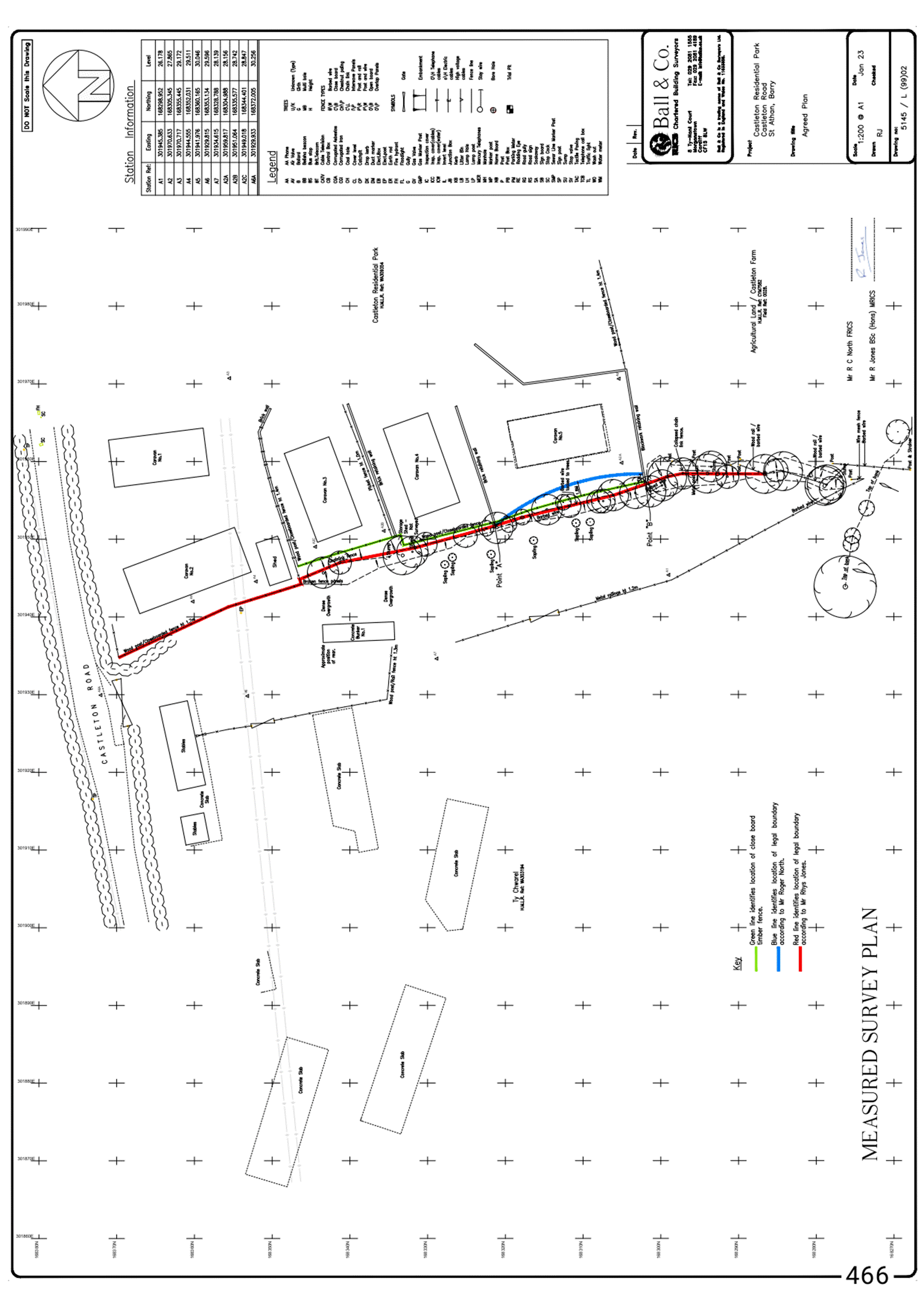
(1) An aerial photograph dated 11 July 1956. This also shows what appears to be a single line of trees in roughly the same place as the 1945 photograph, with similarly placed gaps. This photograph is taken at a slight oblique angle, so that greater care is needed in interpreting it.
(2) An aerial photograph dated 22 May 1969. It is harder to make out the features on this photograph, but it still appears to show a single line of trees in roughly the same place as in the earlier photographs. It additionally shows, however, increased vegetation spreading eastwards onto the defendants' side of the tree line.
(3) An aerial photograph dated 30 July 1981. This continues to show a single straight line of trees, which now appears to extend northwards to meet the boundary of the road. This also shows additional trees/shrubs planted in various places to the east of the tree line, on the defendants' land.
(4) An aerial photograph dated 30 September 1991. This shows the same line of trees, in a relatively straight line until it reaches the southern end of the defendants' land, when it curves back to point in a southwards direction. This photograph shows more extensive growth of trees and vegetation in various place to the east of the tree line, particularly in the area which is now adjacent to the Disputed Section. It also shows the Bunker being surrounded by much increased vegetation, so as to narrow the gap between the Bunker (plus the vegetation growing around it) and the west side of the tree line.
(5) A google-earth photograph from 2001. This shows even more growth eastwards from the tree line, some distance into the defendants' land, particularly adjacent to the Disputed Section. It also shows considerably more growth around the Bunker, such that it is difficult to make out the gap between it (plus the vegetation growing around it) and the west side of the tree line.
(6) Another google-earth photograph from 2018 shows a similar picture, although some of the trees to the east of the tree line in the Disputed Section have by this time been removed. The extent of the growth around the Bunker is such that there appears to be virtually no gap between it and the tree line. Both the google-earth photographs are taken from a slightly oblique angle, compared with the other aerial photographs and need to be treated with some caution.
(7) An aerial photograph dated 2022, which identifies the configuration as it currently exists (except that it was taken before caravan No.5 was erected). This continues to show a relatively straight line of trees, but all growth to the eastern side has been removed. As with the 2018 google-earth photograph, there is no discernible gap between the Bunker (and the vegetation around it) and the western side of the tree line.
The witness evidence
Conclusions